Historical Delta T
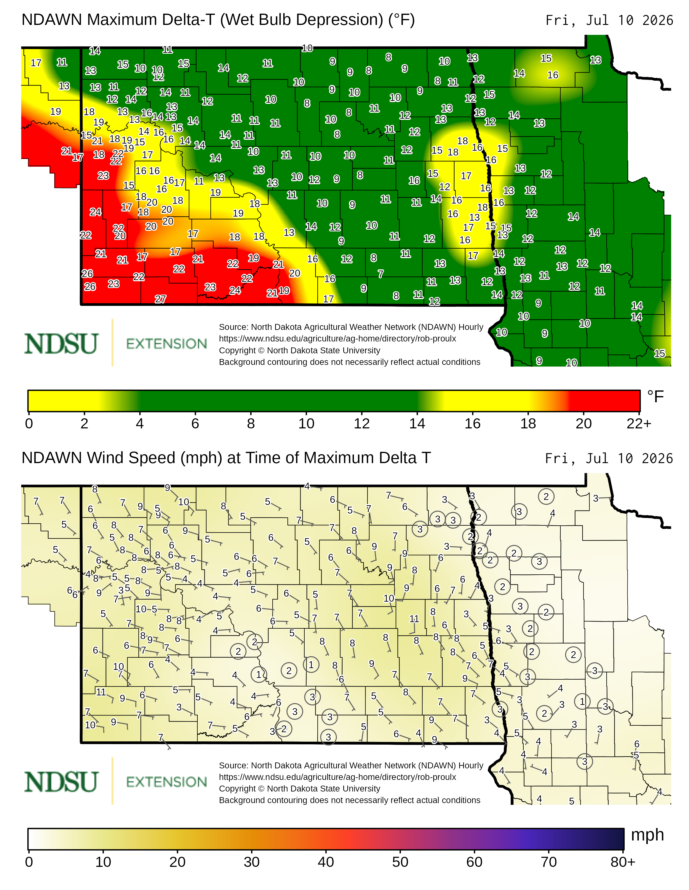
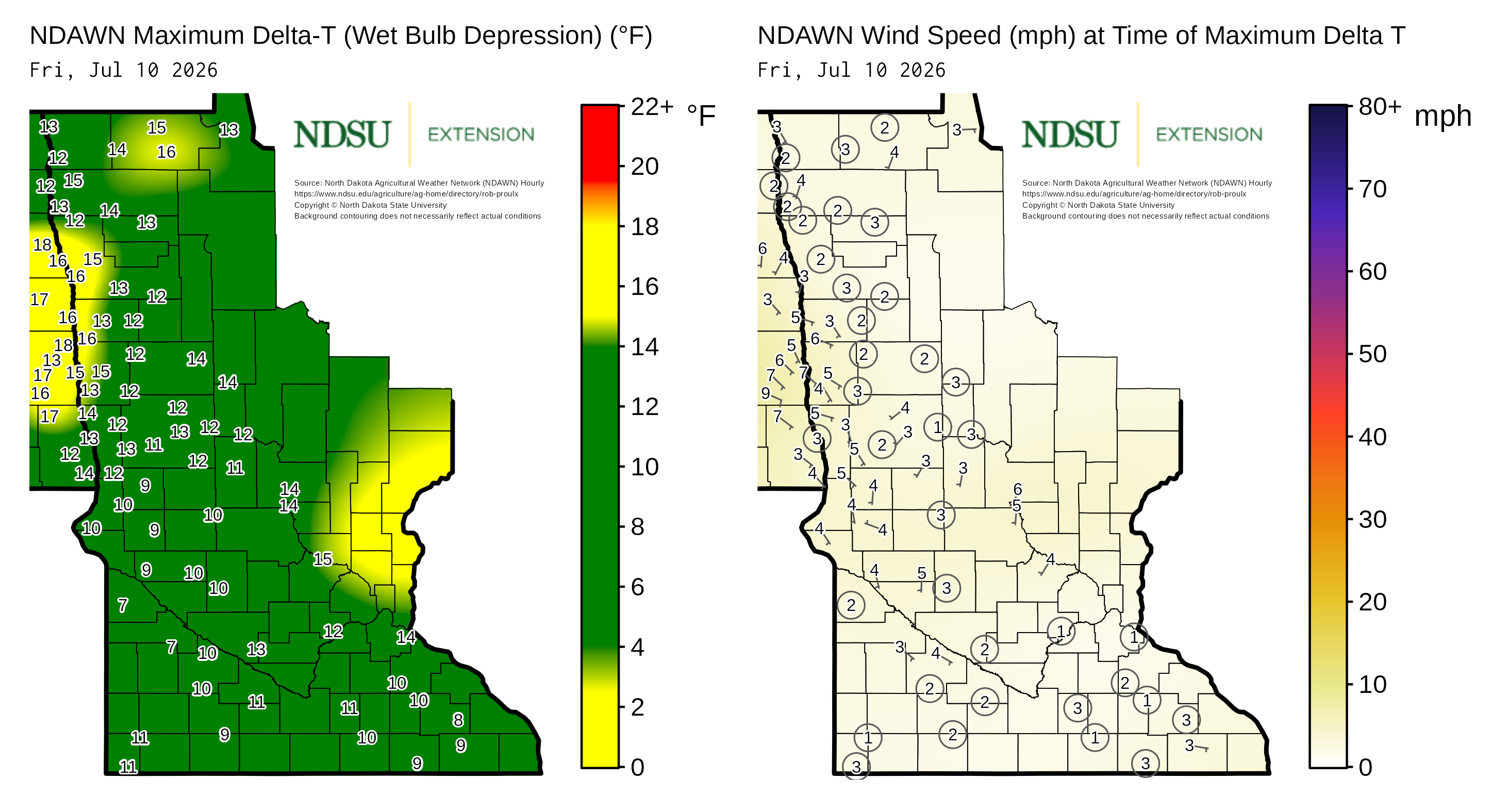
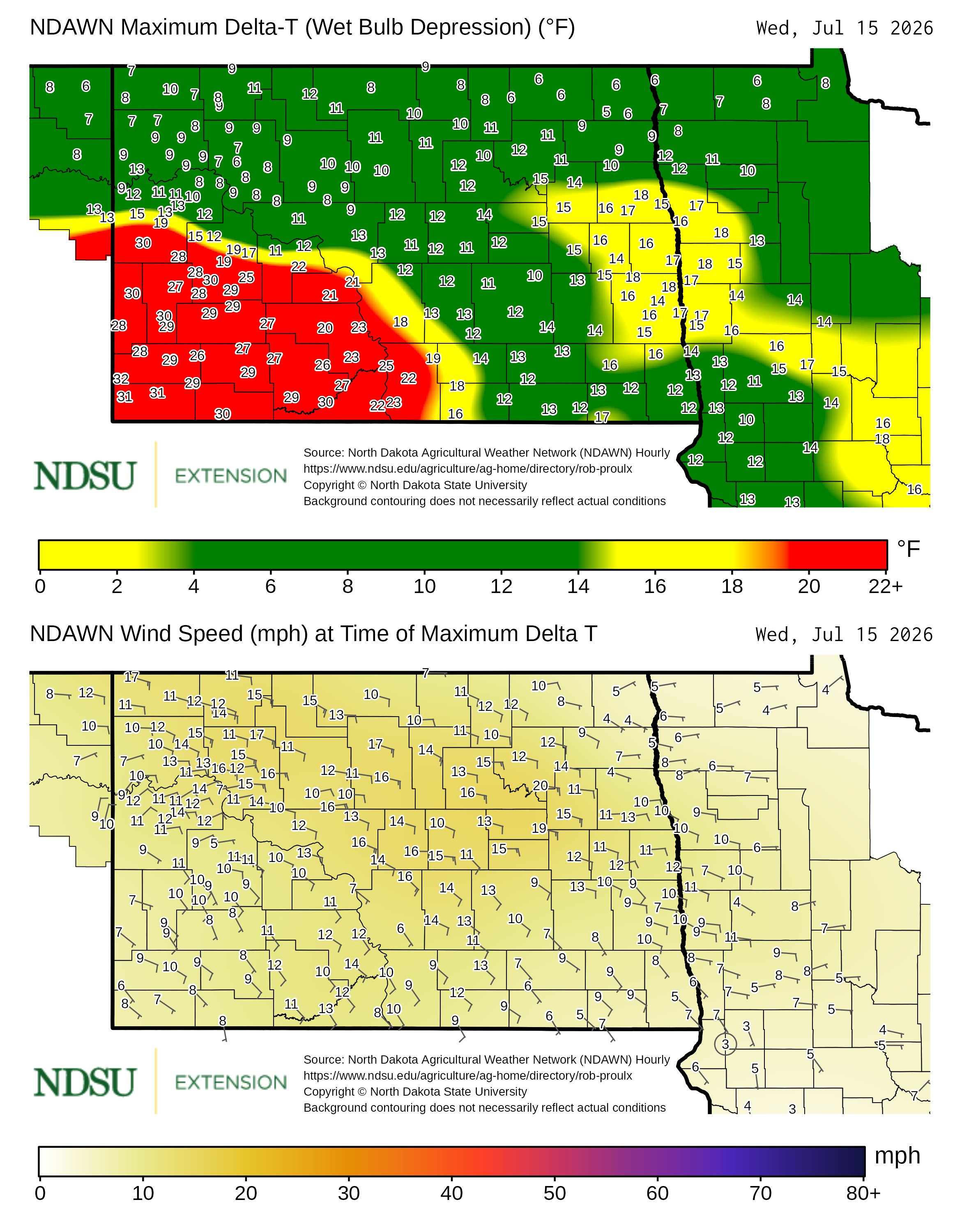
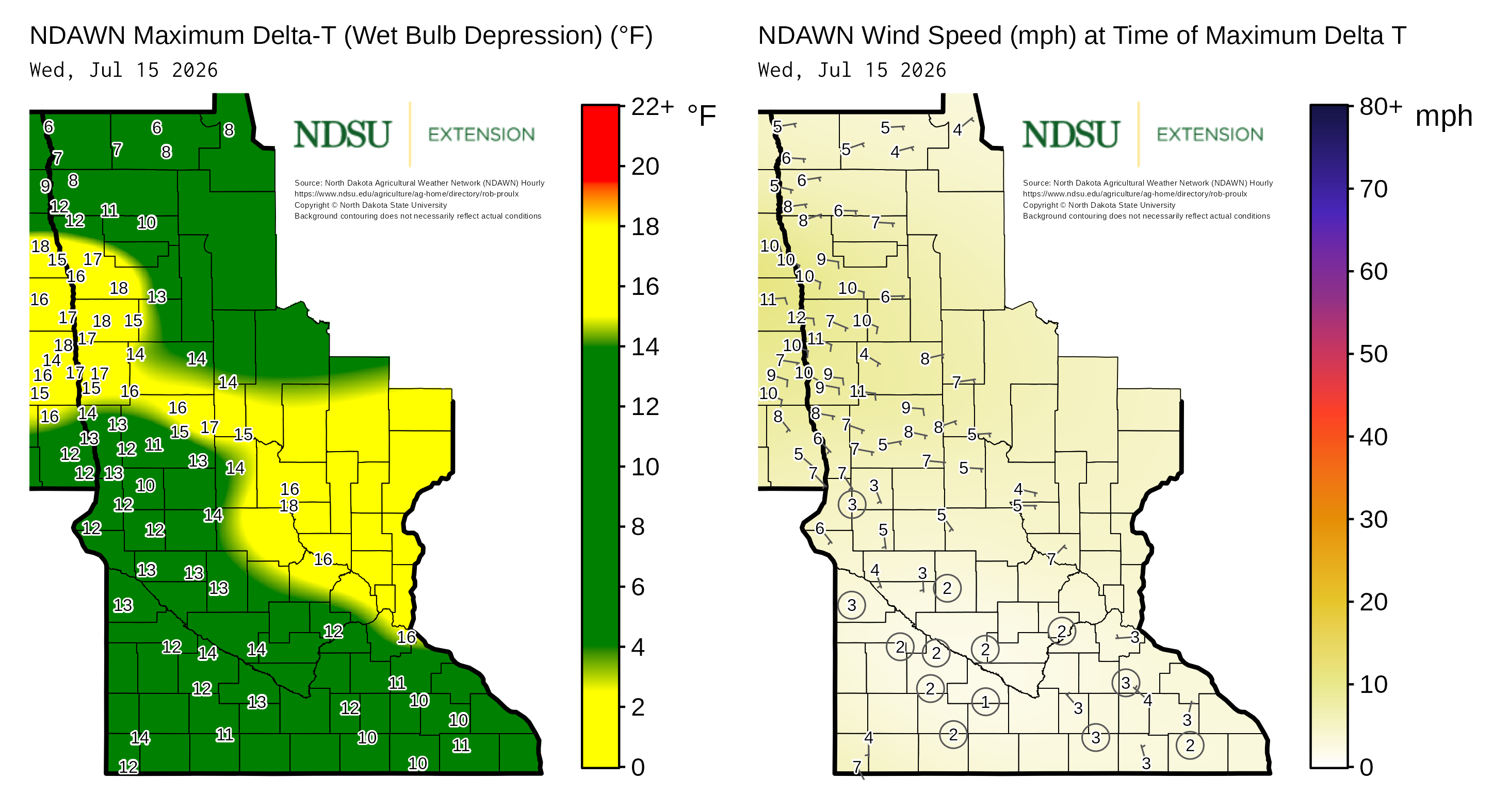
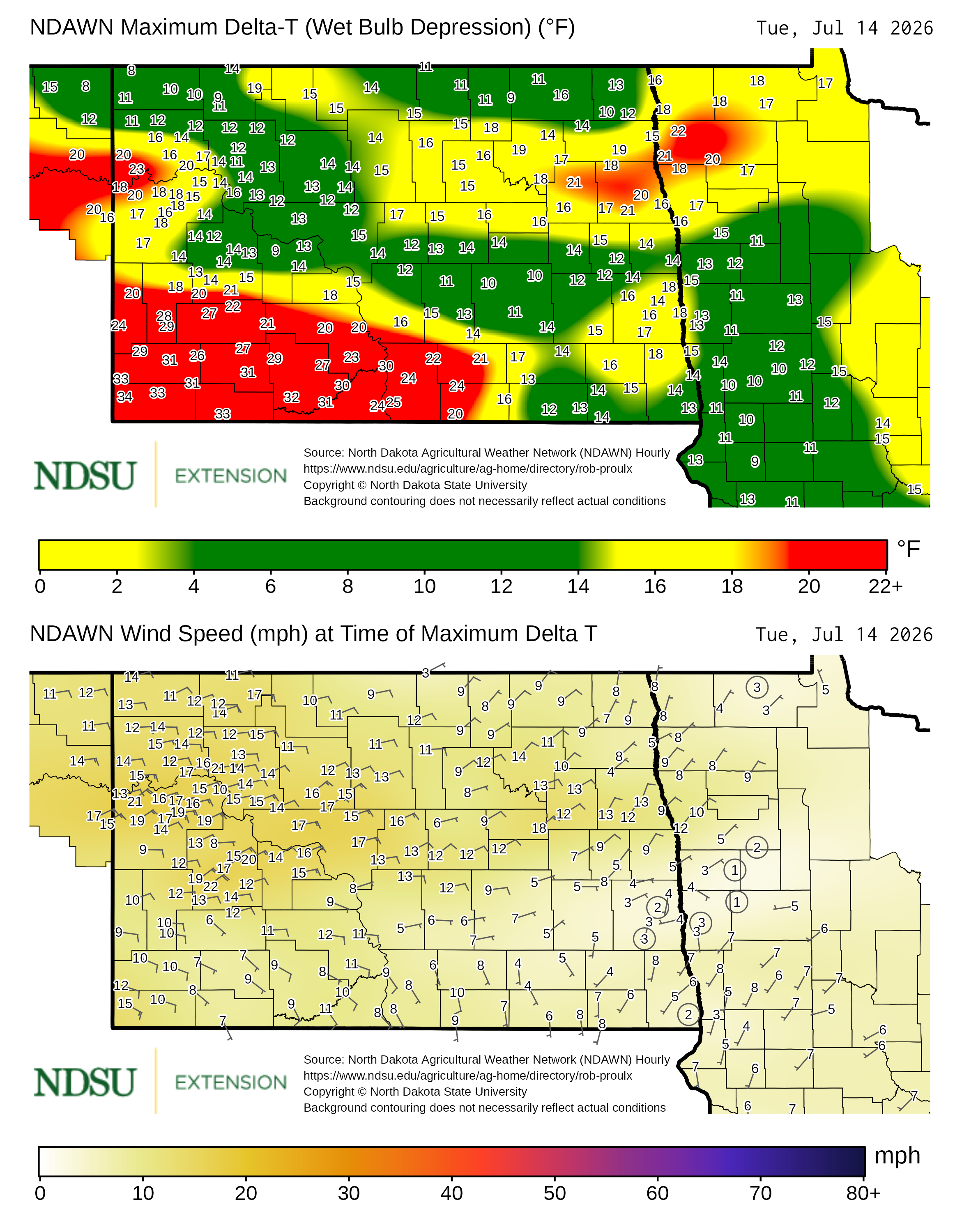
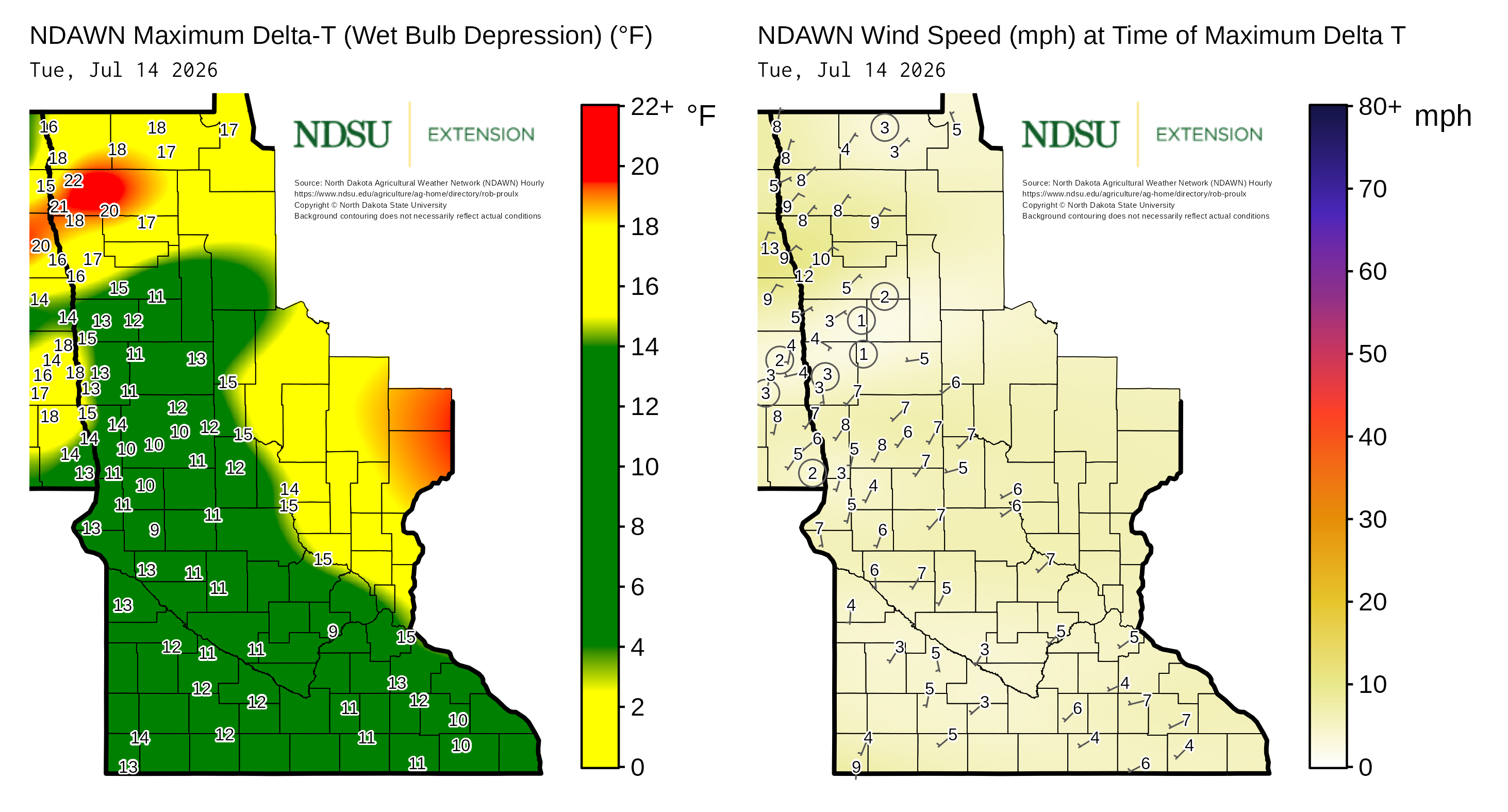
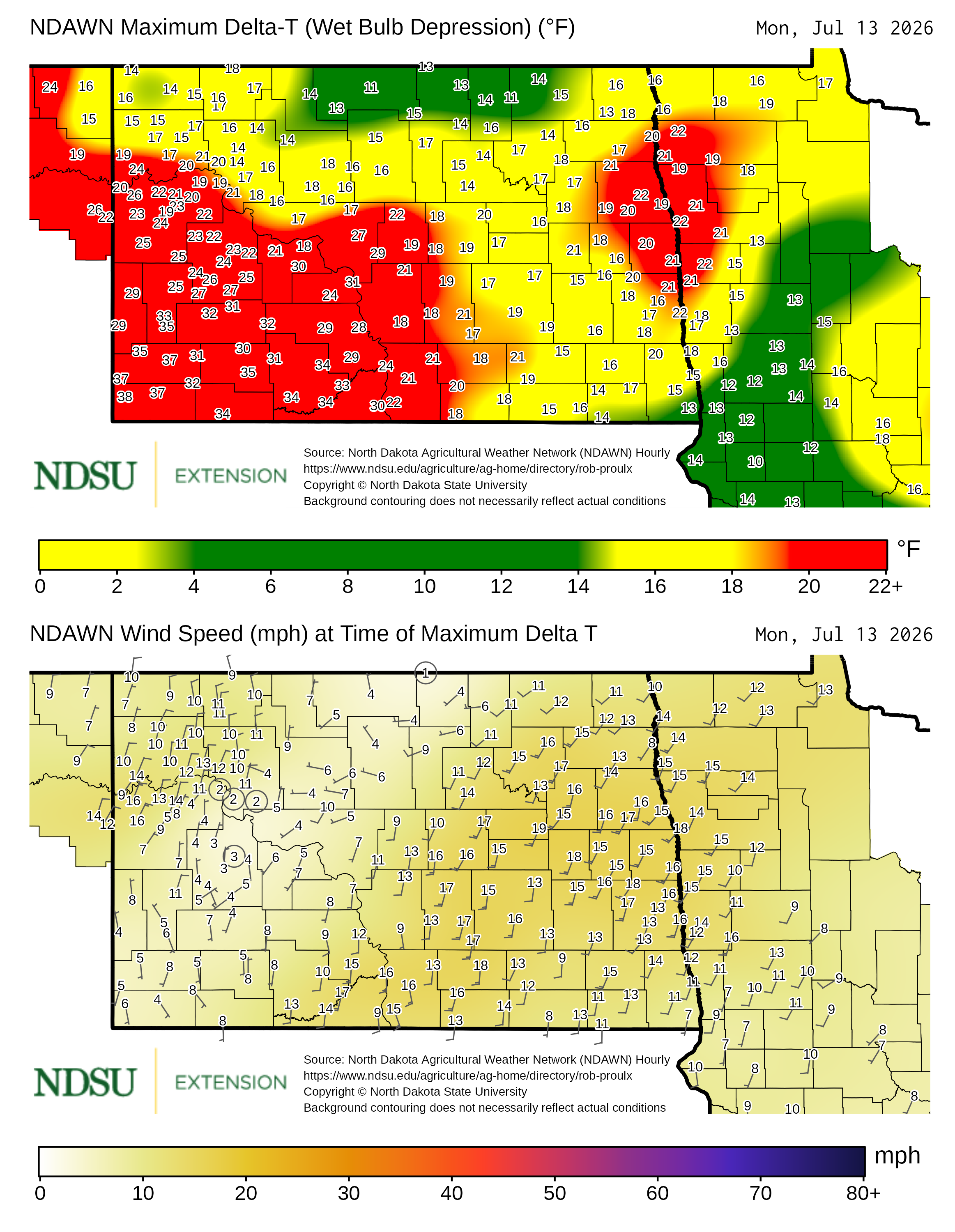
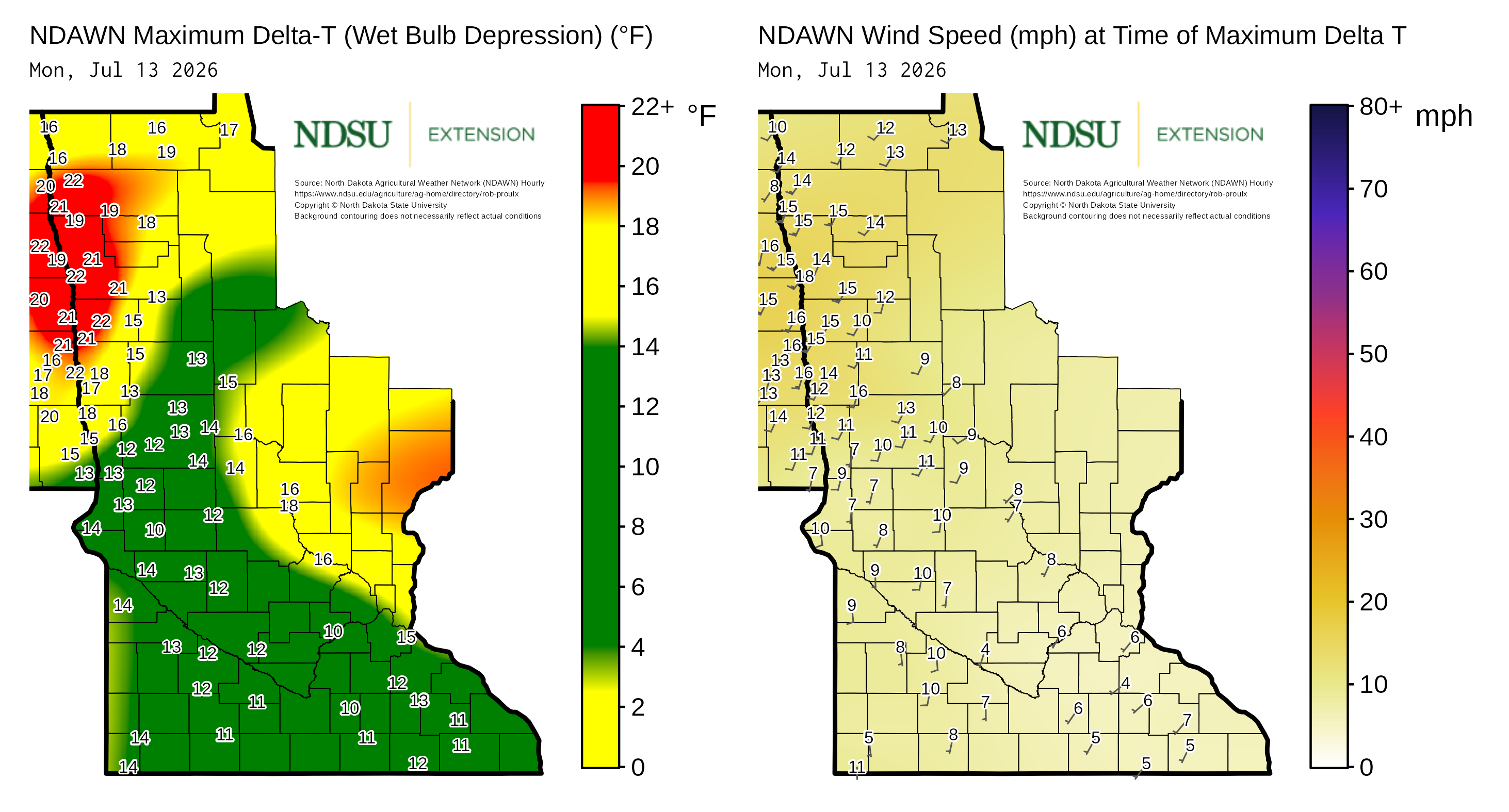
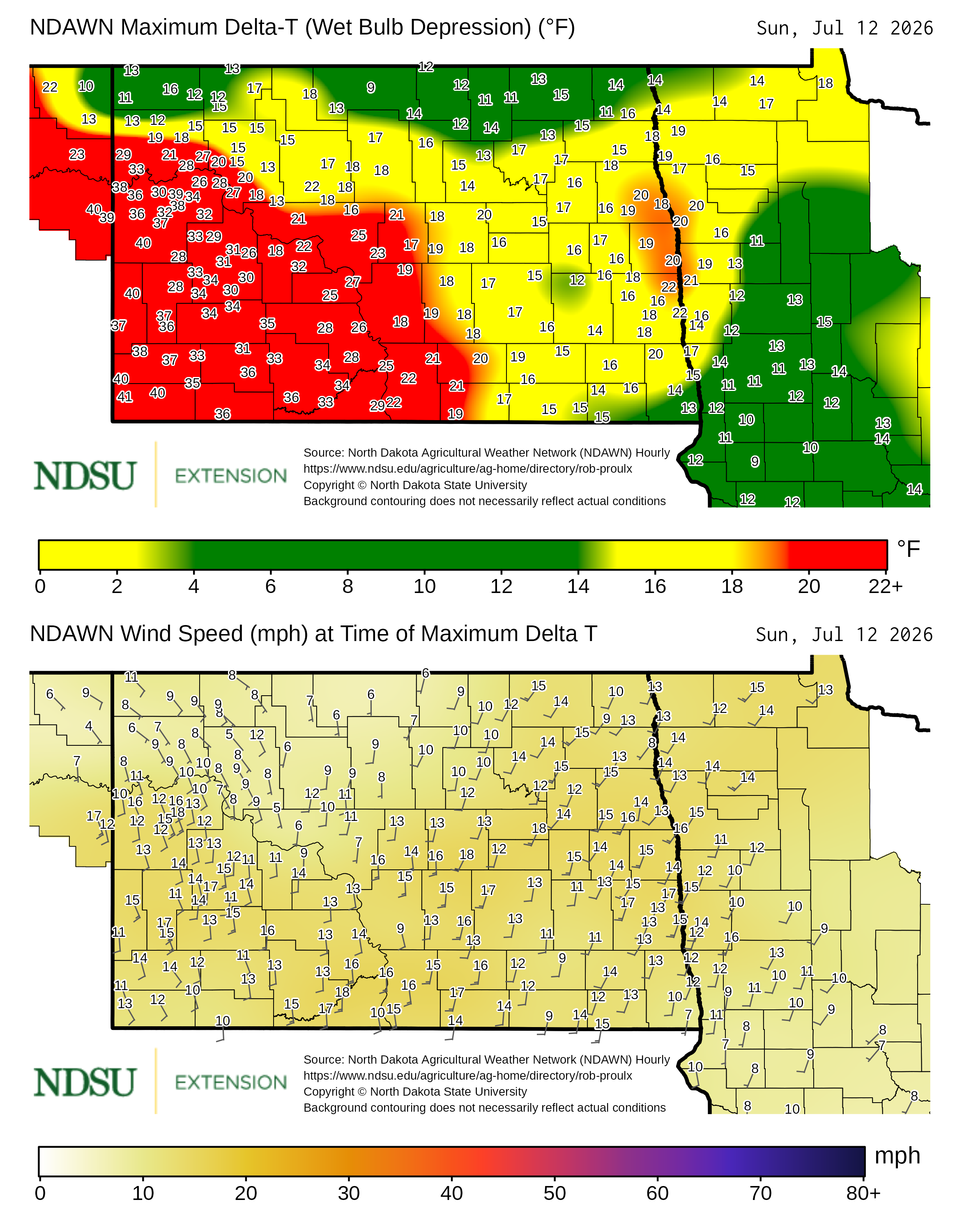
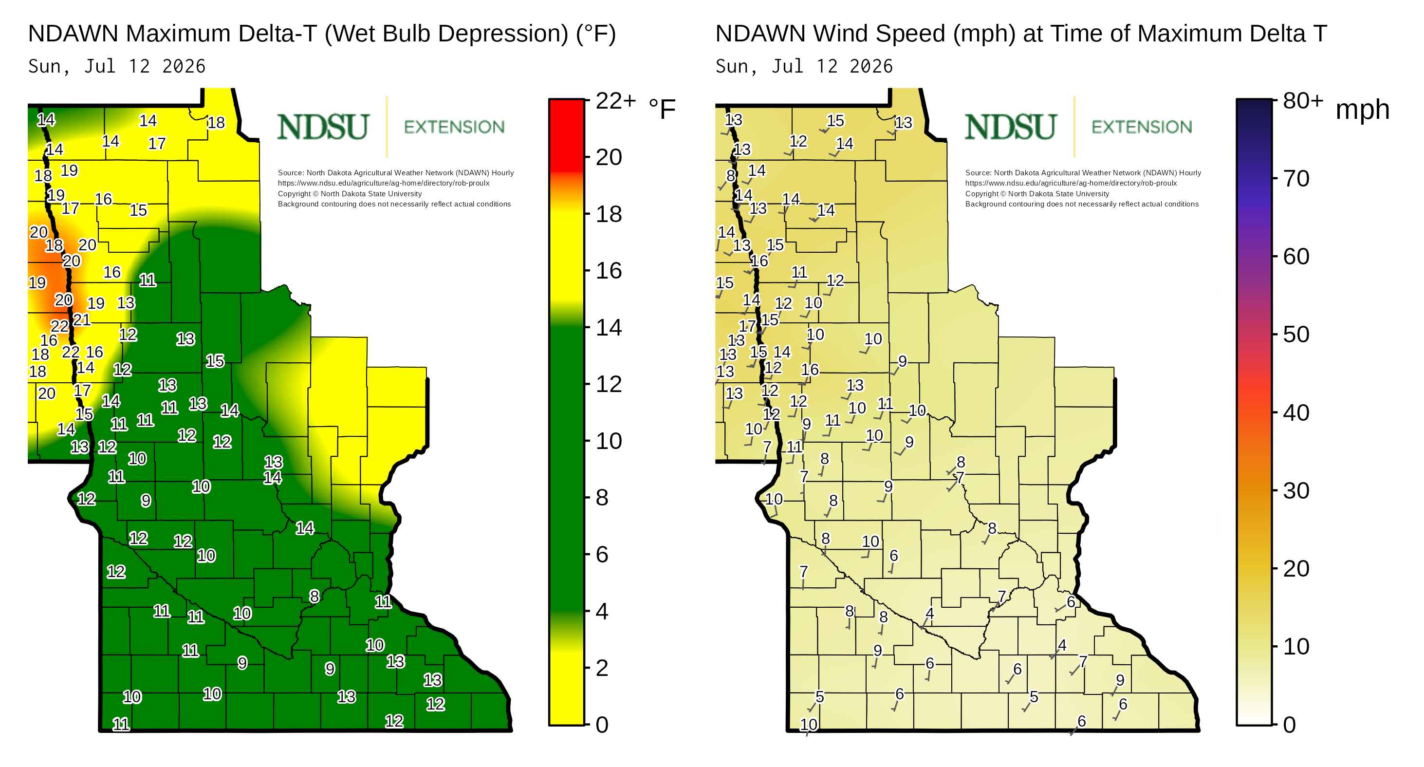
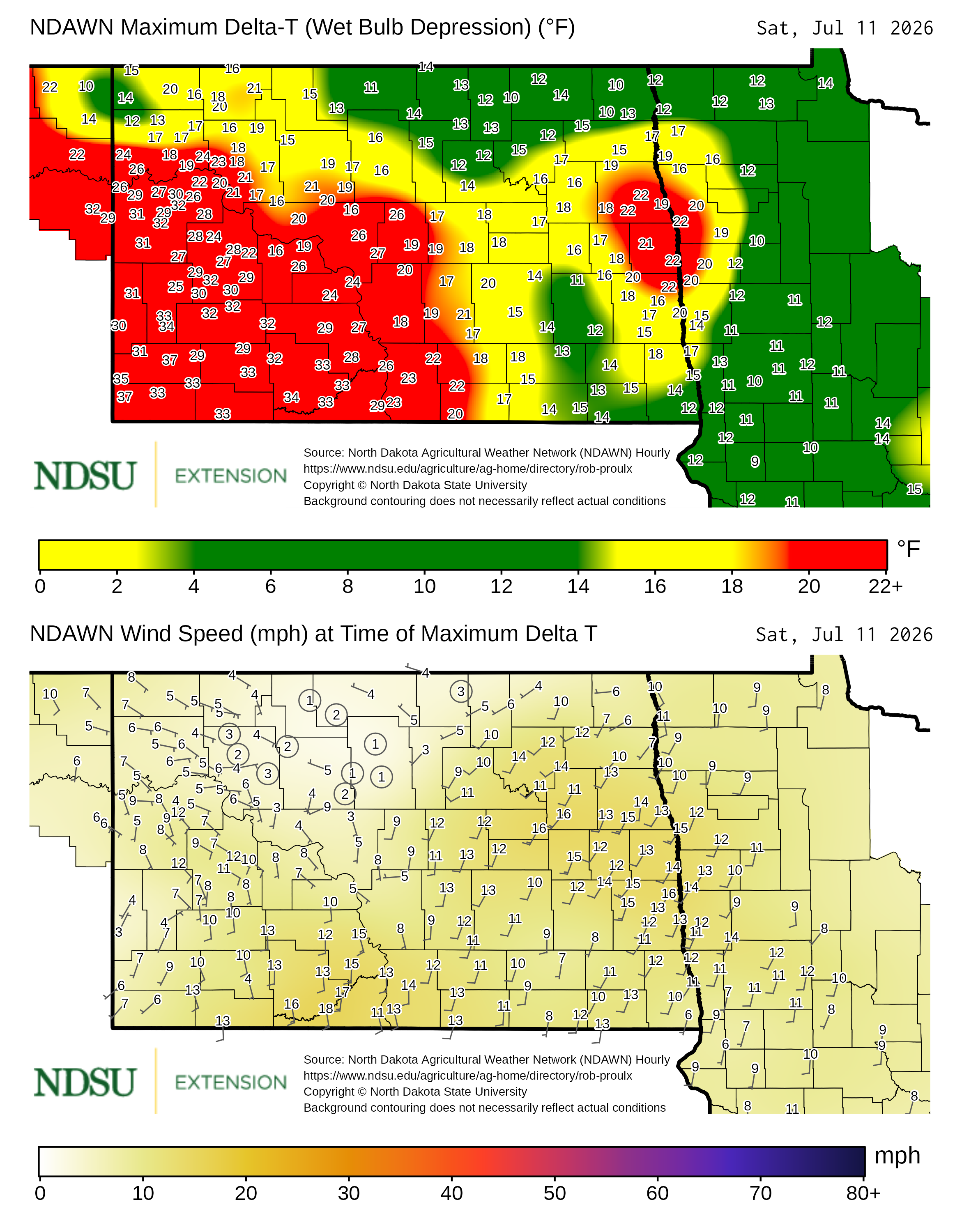
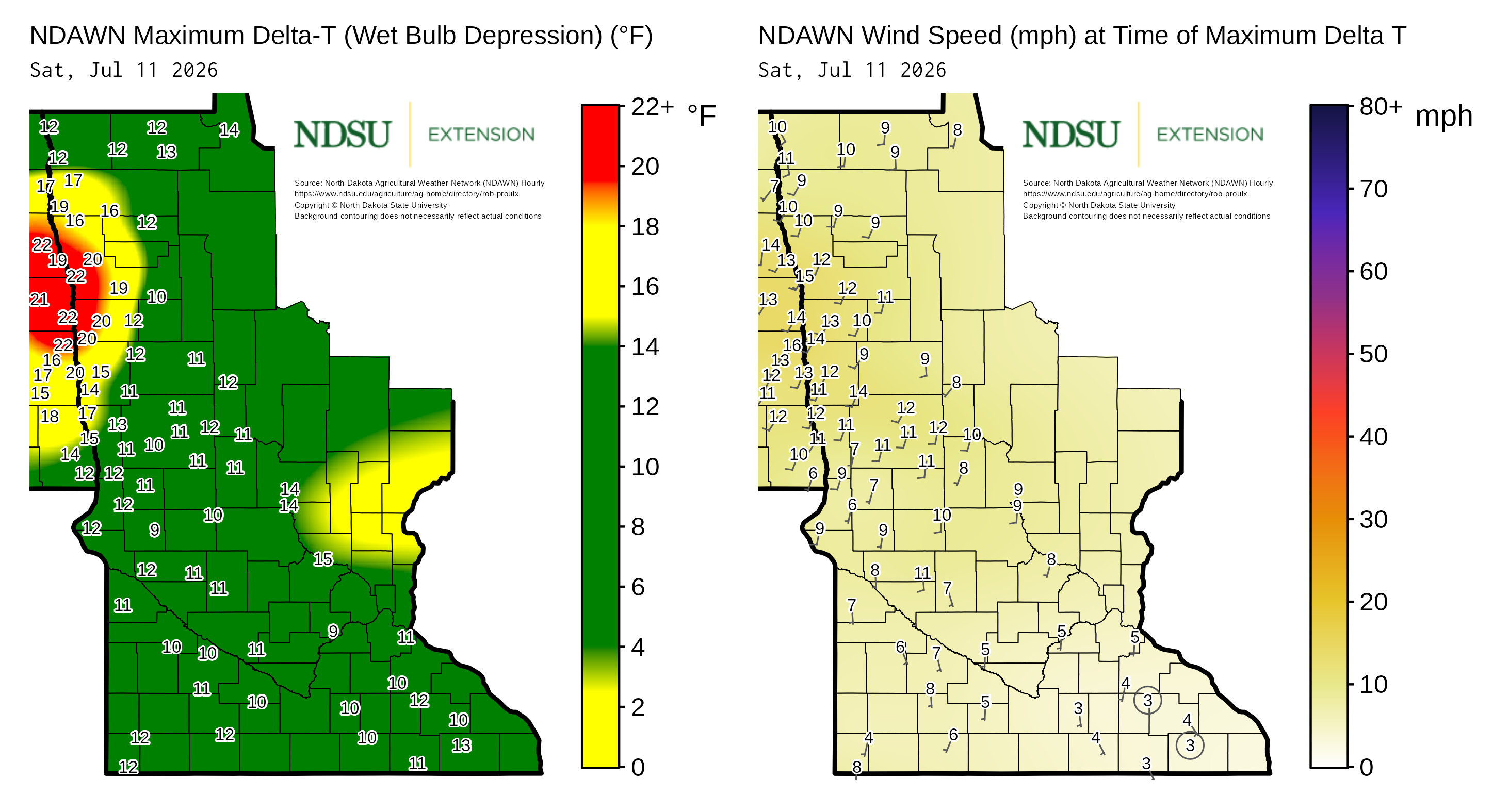
Maps of maximum Delta T and concurrent wind speed are derived from North Dakota Agricultural Weather Network hourly data, which is available at NDAWN.org.
See the Archive for additional historical maps.
Yesterday
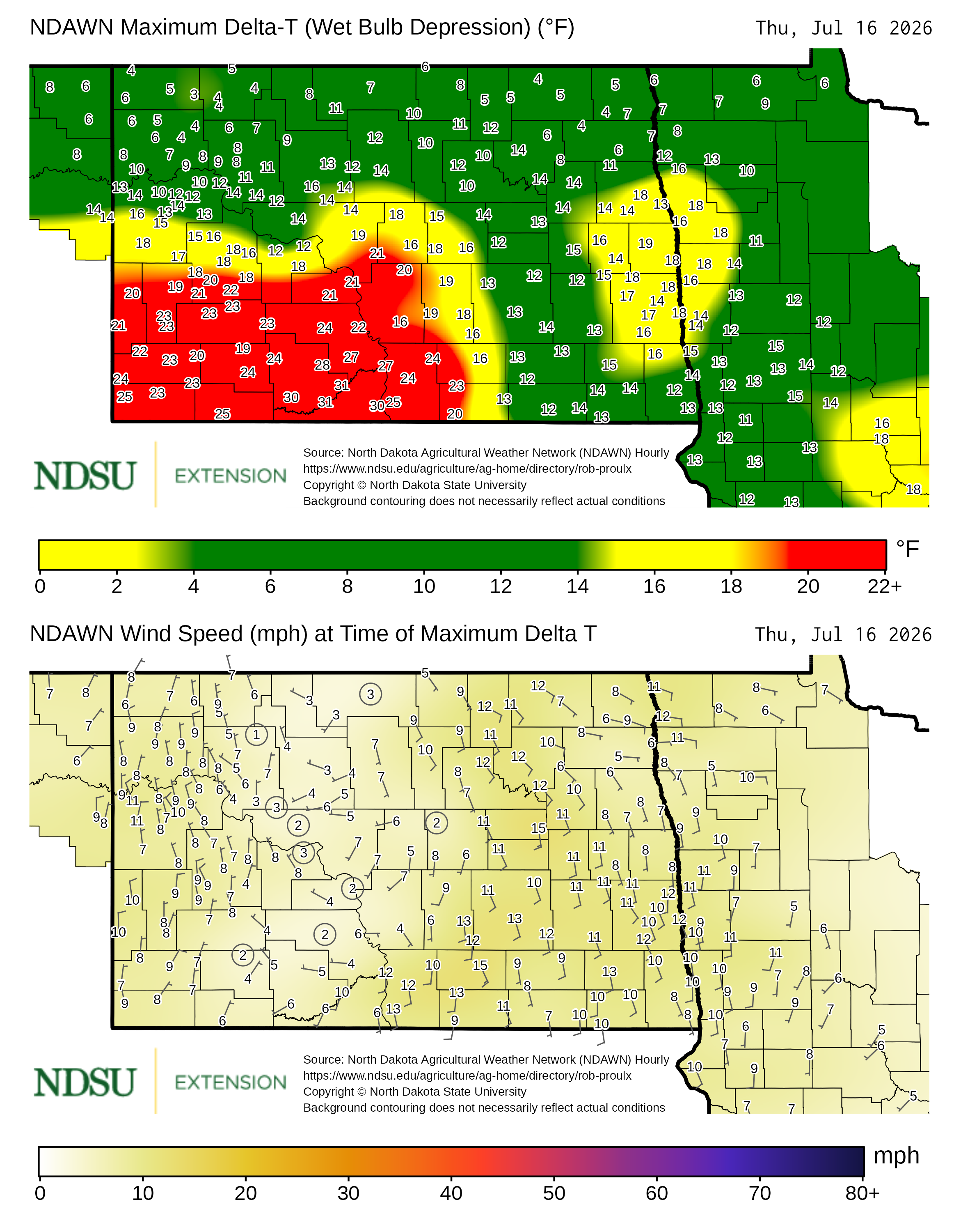
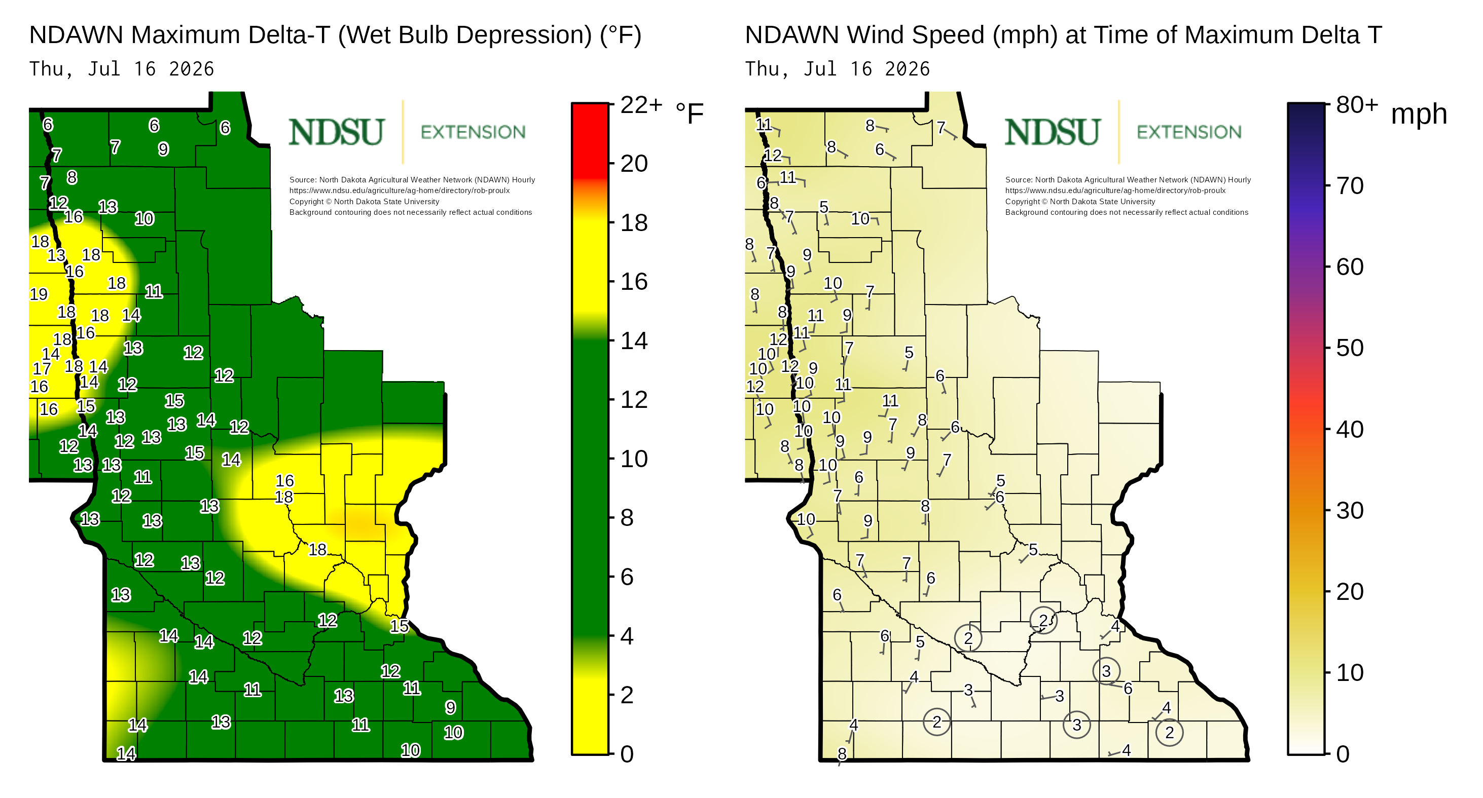
Wednesday, July 15, 2026
Tuesday, July 14, 2026
Monday, July 13, 2026
Sunday, July 12, 2026
Saturday, July 11, 2026
Friday, July 10, 2026